
This map is from A Book of Maps of Cape May 1610-1878 by Horace G. Richards. Being from 1726, it isn’t the earliest map of the area, but it is unique in its detail of the location of Cape May County’s first settlement.
The area of Town Bank (or Portsmouth as the map calls it) was first settled in 1685. According to Richards, the origin of the map is unknown, but the copy in his book was owned by Cape May resident H. Walker Hand. It was likely passed down through the many generations of the Hand family, which is one of the very first families that settled in the county.
It is difficult to judge the scale of the map (scale units given are “rods”) but there are a few landmarks on the map that are recognizable today. The one landmark I recognized is Coxe Hall Creek.
To get a better feel for how this map would drape over our current-day landscape, I brought the old map into a Geographic Information System (GIS). Using georeferencing tools I lined up the old map with landmarks on both historic and modern maps. You can see the results below.
(Use the slider to move between the two maps)
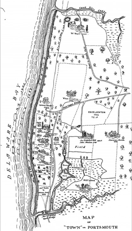
It’s fascinating to see that a few of those old roads are still here in modern times, particularly Town Bank Road and Clubhouse Road (in the upper right of the map).
Stay tuned for future posts when I will go deeper into some of the details of the 1685 map.