
The photo above is a picture from last August of a cardinal flower surrounded by salt marsh cord grass.
It was taken along a south jersey stream that flows out of a forest and into a salt marsh. The juxtaposition of this flower, common along forested streams, and salt marsh grass tells a story of change.
Not long ago, that cardinal flower had different plant neighbors, but as sea level rise pushes the salt line further inland, salt marsh vegetation is making its way upstream displacing freshwater plants like the cardinal flower.
As scary maps tell us about the changes to come, subtle indicators like this odd combination of plants tell us about the changes that are happening right now.
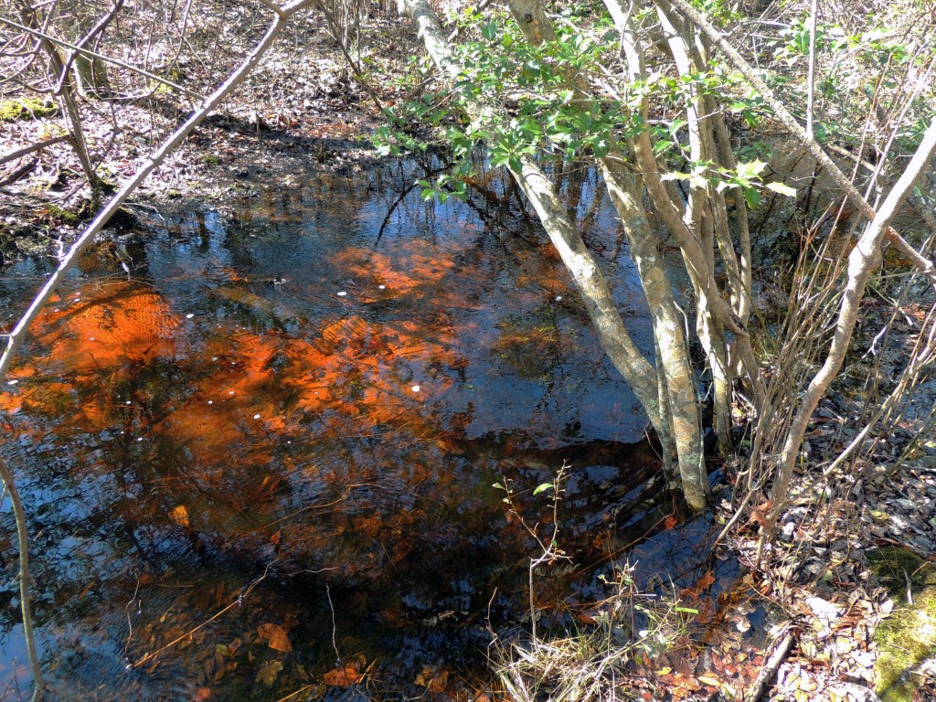
The tea-colored headwaters of a coastal stream
On a walk along a different stream this week I was struck by more indicators of change as salt moves its way up the small watersheds of the Cape May Peninsula.
I was in a forest community type known as the Cape May lowland swamp (see the bottom of this post for more details), which occurs at the headwaters of several coastal streams that rise in swampy woods and wind their way through salt marsh to the ocean or the Delaware Bay.
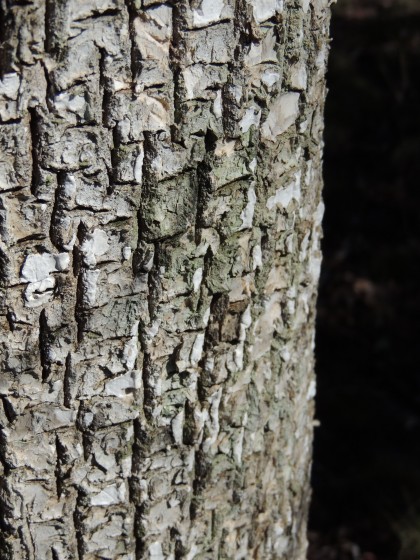
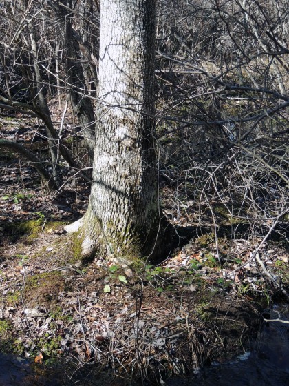
Pumpkin ash bark
It is the wettest time of year in our local swamplands and this little tea-colored stream was over its banks and water was flowing in a shallow sheet across the forest. Despite the abundant freshwater in the woods now, I discovered a few signs that things were changing as I moved downstream.
I found one of the flagship trees of the Cape May lowland swamp, a pumpkin ash, dead along the stream bank. I also noticed some evergreen hollies with only a fraction of their leaves.
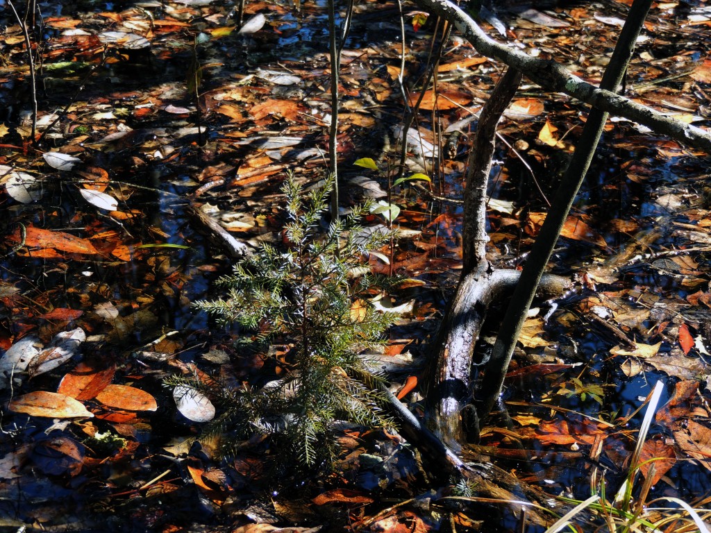
A baby red cedar, harbinger of change
In the understory were a couple of telltale indicators that the location was getting saltier: red cedar seedlings and bayberry shrubs. These are two salt tolerant species. Red cedar is so tolerant of salt that I have frequently seen it colonize areas at the edges of salt marshes where all other trees had been killed by encroaching salt water.
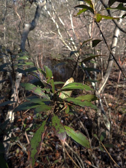
Bayberry, not a characteristic species of the Cape May Lowland Swamp.
This area, fresh as can be now, likely experience more saline conditions in summer when there is less freshwater flowing out of the swamp. During drier times salt water makes its way further inland. It is likely that these salty conditions sickened the hollies and killed the ash.
Making note of these real changes happening now may be able to help us come to terms with the much larger, but less tangible changes those scary sea level rise maps portend.
A healthy ash upstream, still far away from the salt.
(Excerpted from Press of Atlantic City, Tuesday, May 2, 2000)
Cape May lowland swamp: A rare swamp ecosystem that harbors plants typically found in the southeastern United States, as well as plants found well north of the Pinelands.
“Basically, it’s a southern lowland swamp without the cypress trees,” said Keith Seager, an amateur botanist who helped Department of Environmental Protection’s Natural Heritage Program detail the variety of plants here.
The list includes 29 plants on the state’s endangered list, including pumpkin ash, swamp cottonwood, southern rain orchid, southern tway blade (the state’s earliest blooming orchid) and a large pink species of St. John’s Wort that hadn’t been seen in the state for 80 years until Seager rediscovered it.
The canopy includes trees characteristic of swamp forests in the Southeast, including loblolly pine, pond pine, swamp chestnut and water oak, which reaches its northern limit in Cape May County.
Growing abundantly under the trees are 37 shrub species, including highbush blueberry, sweet pepperbush and swamp azalea.Cape May lowland swamps, as their name implies, are found mostly in Cape May County, with lesser examples found along Cumberland County’s bay shore.
Geography plays a major role in allowing the swamps to host their unique variety of plants. Cape May County generally is warmer than the rest of the state, because it is nearly surrounded by water and because its latitude dips as far south as Washington, D.C., said Dave Snyder, a botonist with the DEP’s Natural Heritage Program.Cape May lowland swamps are considered “critically imperiled” by the Natural Heritage Program, meaning no more than five such swamps remain in the state. Such status, however, offers the swamps no additional legal protection.